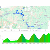
Giro 2025 Route stage 19: Biella – Champoluc

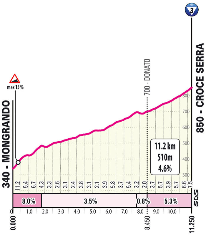
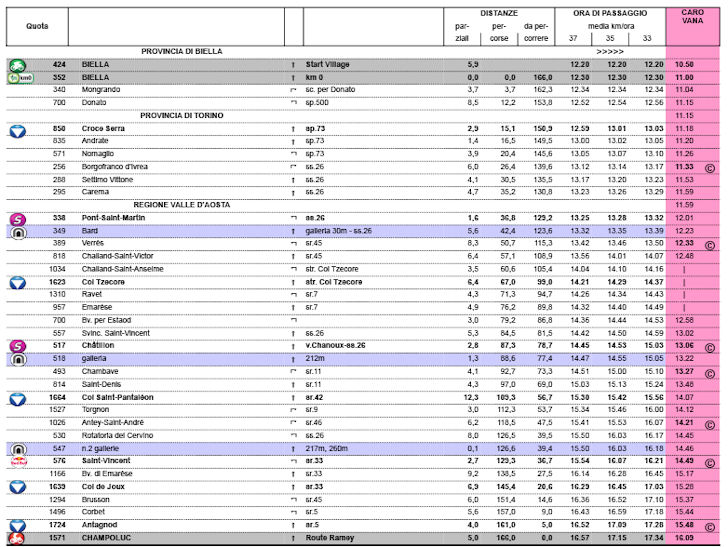
The climbing starts almost immediately with the Croce Serra, an 11.2-kilometre ascent at 4.6%. After the descent, the route continues for over 20 kilometres through the valley before the first of three long climbs begins at kilometre 50.
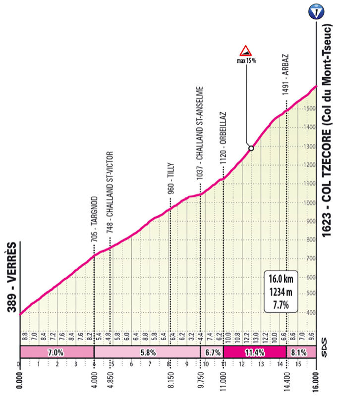
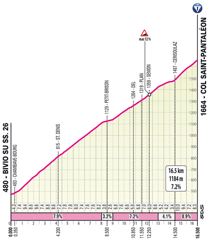
The Col Tzecore rises for 16 kilometres at an average gradient of 7.7%, with sections ramping up to 15%. Following the descent, the riders face around 10 kilometres in the valley before tackling the Col Saint-Pantaléon – a 16.5-kilometre climb at 7.2%, with gradients peaking at 12%. From the summit, 57 kilometres remain.
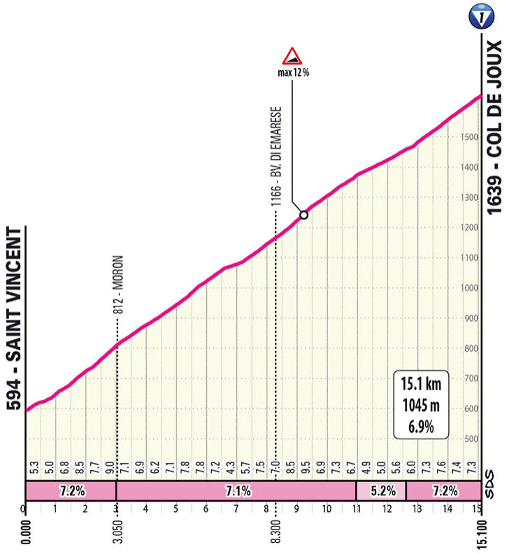
A 20-kilometre descent brings the riders to the Col de Joux. Similar to the previous climb but slightly less demanding, this ascent spans 15.1 kilometres at 6.9%, with maximum gradients of 12%. The descent leads to Brusson, located at the foot of the day's final climb.
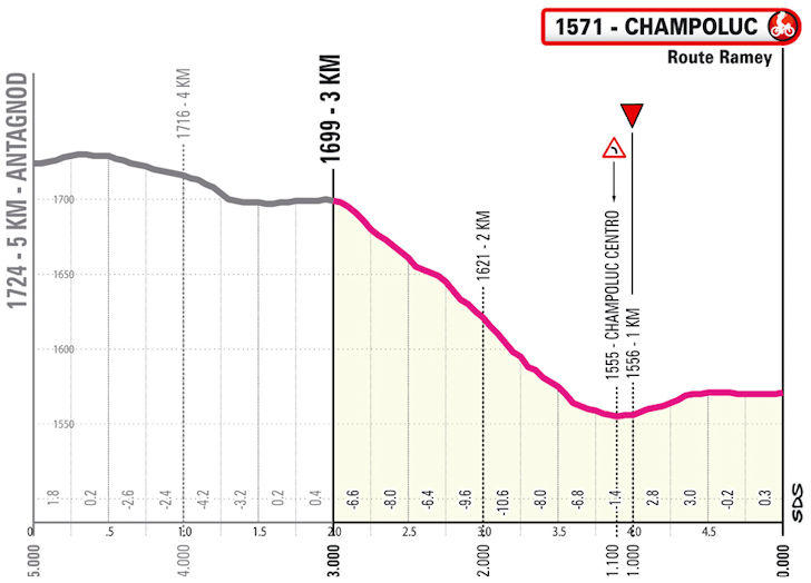
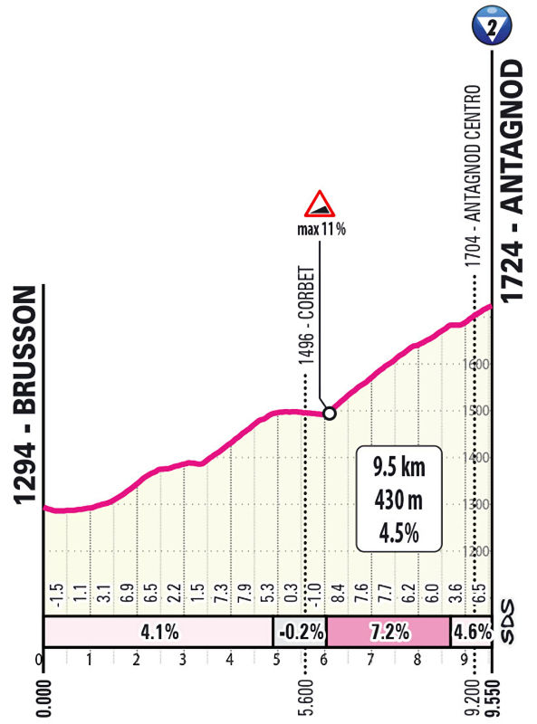
It's an 9.5 kilometres uphill drag at an average gradient of 4.5%. The riders pass through Antagnod before entering the final 5 kilometres downhill.
The finish venue, Champoluc, is the main hub of the Monte Rosa ski area. Monte Rosa is part of Europe’s second-largest mountain massif, after Mont Blanc. At 4,634 metres, the Dufourspitze is the highest peak of the massif, but the riders will not get anywhere near that altitude. Antagnod, at 1,724 metres above sea level, marks the highest point of the day.
Ride the route yourself? Download GPX 19th stage 2025 Giro d'Italia.
Another interesting read: results 19th stage 2025 Giro d'Italia.
Giro d'Italia 2025 stage 19: routes, profiles, videos
Click the images to enlarge