Tour Auvergne-Rhône-Alpes 2026 Route stage 4: Le Puy-en-Velay - Montrond-les-Bains
![]()
First published 8 June 2026 - last updated 8 June: weather conditions added
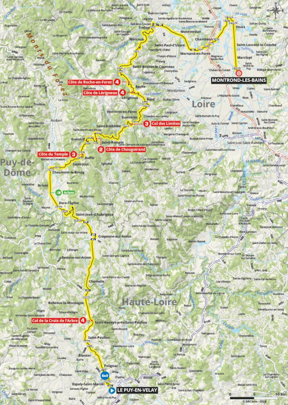
Shortly after the start in Le Puy-en-Velay, the road begins to rise, ultimately leading into the Col de la Croix de l'Arbre, a 4-kilometre climb at an average gradient of 4.1%. The riders then remain at altitude for roughly 25 kilometres before the ensuing descent takes them down to the intermediate sprint in Arlanc.
The 60 kilometres following the intermediate sprint form the hilly heart of the stage. First comes the Côte du Temple (5.7 kilometres at 4.5%), followed, with hardly any descent in between, by the Côte de Chougoirland (7.8 kilometres at 5.5%). The riders then plunge down towards the foot of the Col des Limites (3.7 kilometres at 5.5%), after which the downhill run continues to the base of two successive climbs: the Côte de Lérigneux (1.7 kilometres at 4.4%) and the Côte de Roche-en-Forez (2.1 kilometres at 4.5%).
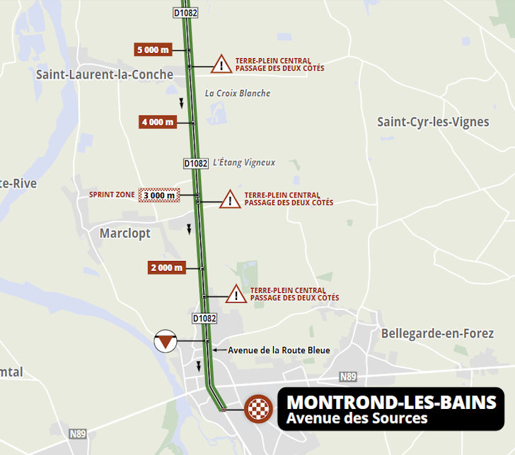
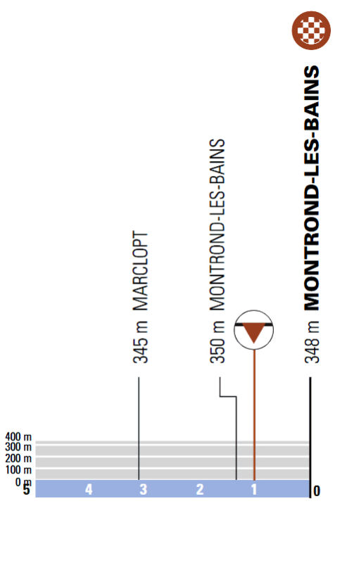
After the KOM sprint in Roche-en-Forez, the road continues to drag uphill for a few more kilometres before the final descent begins with 53 kilometres remaining. Once down in Trelins, the riders face a further 35 kilometres of flat roads to the finish.
Fancy riding the route yourself? Download GPX 4th stage 2026 Tour Auvergne-Rhône-Alpes 2026.
Weather conditions:
Start: 19°C, sunny, north-westerly wind (force 3)
Finish: 20°C, sunny, north-westerly wind (force 3)
We update the weather forecast on the morning of the stage. For the latest conditions along the route, please use the interactive weather map in the slideshow below this article.
Stage 4 of the Tour Auvergne-Rhône-Alpes starts at 13:05 and the race is expected to finish around 17:10 - both local times (CEST).
Tour Auvergne-Rhône-Alpes 2026, stage 4: routes, profiles, video's
Click the images to enlarge


Comment
No comments yet, please share your view!