Giro 2026 Route stage 14: Aosta - Pila
![]()
Last updated 23 May 2026: link to stage results added
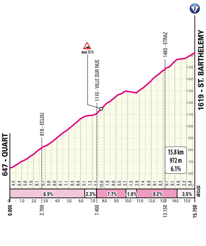
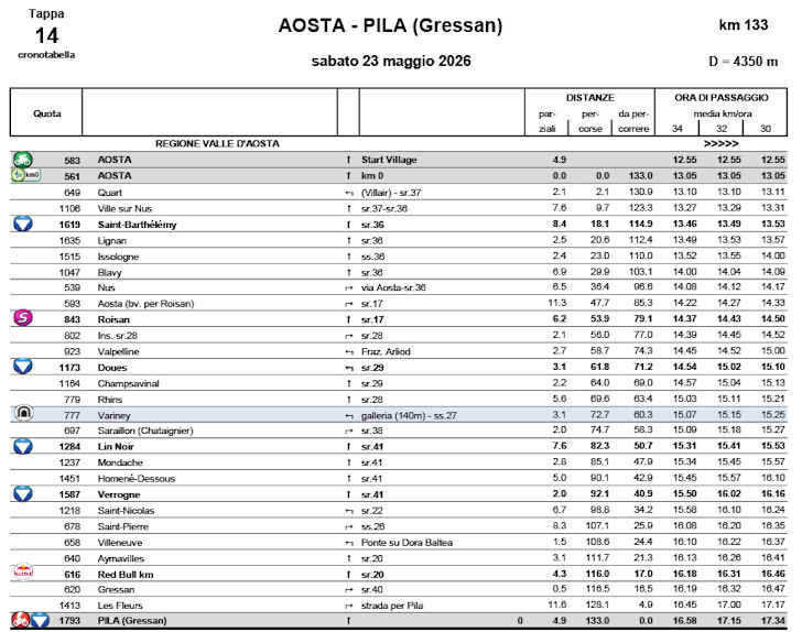
After rolling out of Aosta, the riders head east through the valley and it doesn't take long before they tackle the Saint-Barthélemy climb. The 15.8 kilometres ascent at 6.1% tops out at 1,619 metres.
The riders fly back down into the Aoste valley, only to follow it in the opposite direction. Once they return to the start town, the road climbs for 3.5 kilometres at 5.5% towards Roisan. The gradient eases for a moment before kicking up again on the ascent to Doues, which runs for 5.8 kilometres at an average of 6.2%.
The riders descend back towards Aosta — this time without actually entering the city — before the road turns uphill again on the Lin Noir: 7.4 kilometres at an average of 7.9%. There is no real descent afterwards. The road briefly dips before continuing uphill to the highest point of the day, Verrogne. That section is 5.6 kilometres long and averages 6.9%. As the Giro passes through the mountain village, just over 40 kilometres remain.
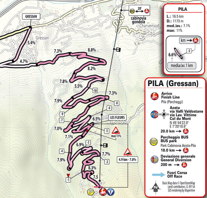
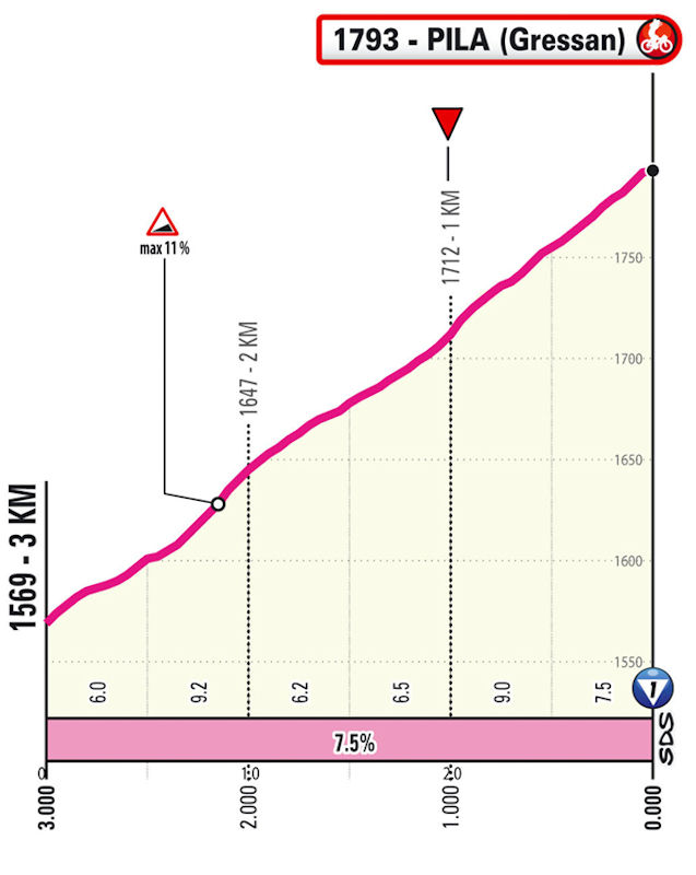
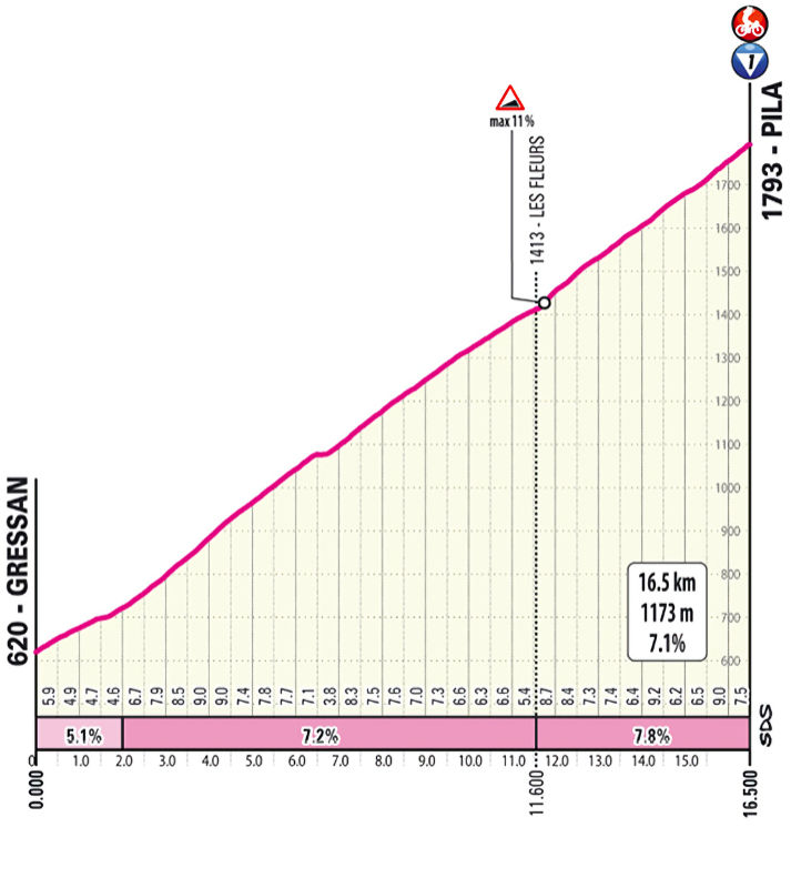
Again, the route drops down into the Aosta Valley, and after roughly 10 kilometres on the flat the final climb opens on the other side of the valley. The climb to Pila is 16.5 kilometres long and the average gradient sits at 7.1%.
Pila is a ski resort set on a high plateau, easily reached from Aosta via gondola. It offers stunning views, including a panorama of Mont Blanc.
Time bonuses of 6, 4 and 2 seconds are up for grabs at the intermediate sprint at kilometre 116.0; at the finish line, 10, 6 and 4 await the first three riders.
Fancy riding the route yourself? Download GPX 14th stage 2026 Giro d'Italia.
Another interesting read: results 5th stage 2026 Giro d'Italia.
Giro d'Italia 2026 stage 14: routes, profiles, videos
Click the images to enlarge


Comment
No comments yet, please share your view!