Critérium du Dauphiné 2017 Route stage 2: Saint Chamond – Arlanc
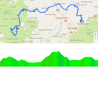
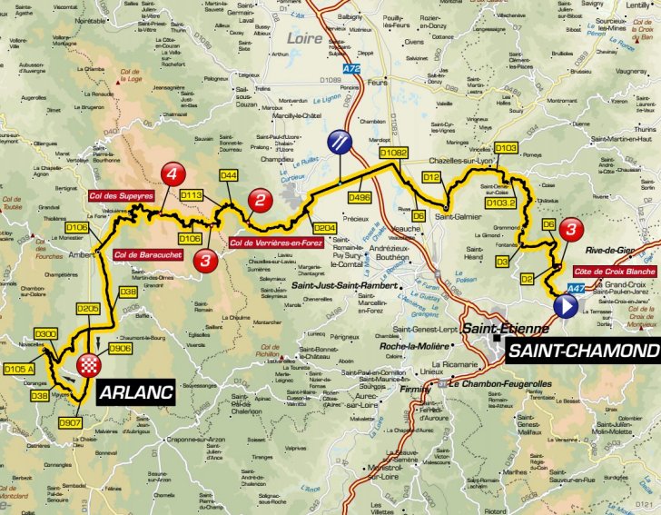
Shortly after the flag is dropped the riders tackle Côte de Croix Blanche, a 4.6 kilometres climb at 4.1%. The route continues slightly uphill before the drop begins at kilometre 10.
The focus of the race is a three-stage ascent halfway. At kilometre 69 the riders reach the base of Col de Verrières-en-Forez - a 9 kilometres climb at 4.8%. No descent at the highest point though as the route continues on Col de Baracuchet, which is a 6.2 kilometres ascent that is averaging 4.9%. Once again no descent at the 'top', as a rolling section of a couple of kilometres runs to Col de Supeyres with its summit after a 2.9 kilometres climb at 5.6%. At an elevation of 1,365 metres this is the highest point today. And, finally, a drop...
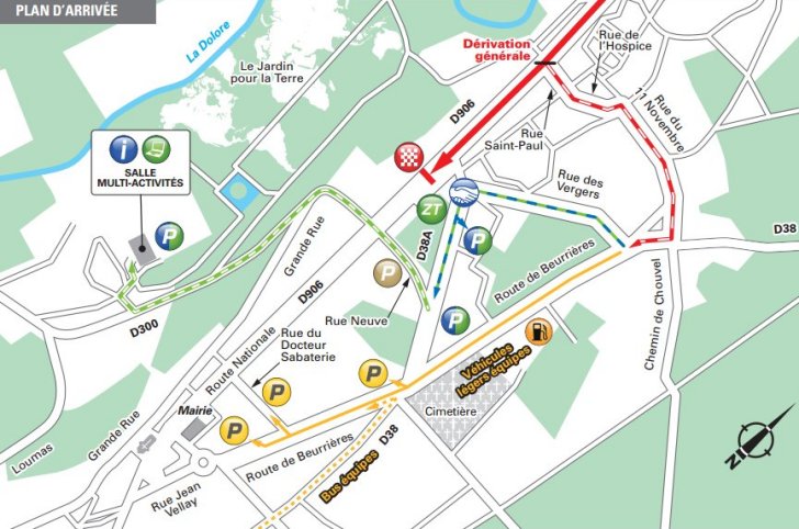
The last 50 kilometres of stage 2 in the 2017 Critérium du Dauphiné are played out on flat to rolling roads. The arrival runs slightly uphill.
The first three riders on the line take time bonuses of 10, 6 and 4 seconds.
Results/race report 2nd stage Critérium du Dauphiné.
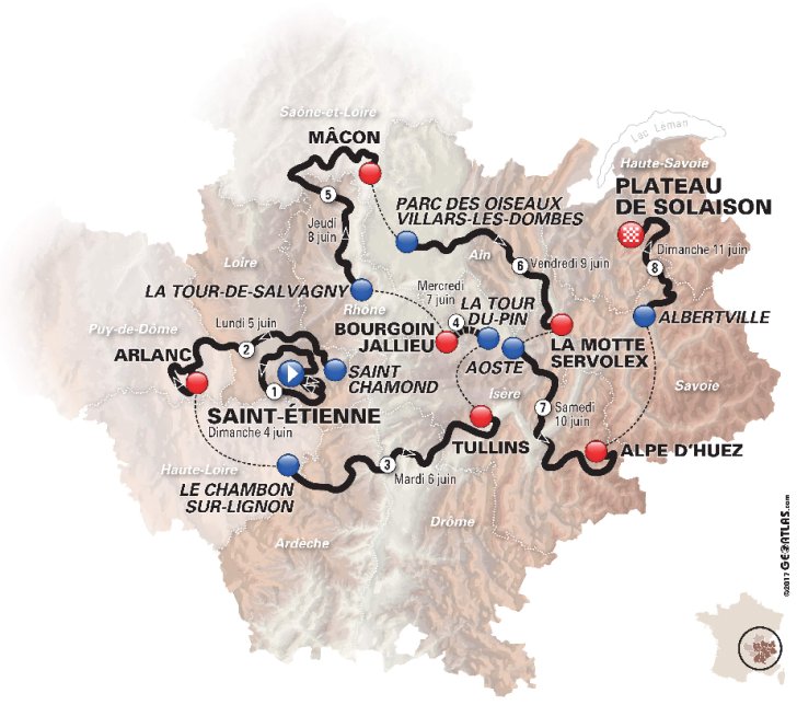
Critérium du Dauphiné 2017 stage 2: Route maps, height profiles, and more
Click the images to enlarge


 Start and finish at Google Maps
Videos Critérium du Dauphiné
 Instagram @criteriumdudau...
 Critérium du Dauphiné Tweets