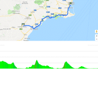
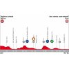
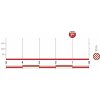
Stage 6 is a likely sprint stage. Which doesn’t mean the route is entirely flat. En route the riders are to crest the Alto de Garrobillo and the Alto Cuesta de Cedacero, both 3rd category ascents.
The Garrobillo – 3.8 kilometres at 5.8 % with the last 2.8 kilometres at 7.9% – is crested with 98.4 kilometres remaining, while the Vuelta travels over the Cuesta de Cedacero some 50 kilometres before the finish. This climb is slightly longer than the previous one, it counts 5.2 kilometres and the average slope is 5.2%.
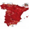
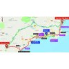
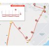
The 6th stage runs mostly along the coast. Shortly after the flag has been dropped the course heads to the Mediterranean Sea and the riders move through Aguilas, Mazarròn and port city Cartagena to Europe’s largest salt water lagoon, Mar Menor. The last 15 kilometres of the route are entirely flat, so that’s plenty of time for the sprint teams to organize their troops.
The arrival place lies 30 kilometres to the south of the Salinas of Torrevieja, where the Gran Salida of the 2019 Vuelta is set to take place.
The first three riders on the line take time bonuses of 10, 6 and 4 seconds, while the intermediate sprint (at kilometre 118) comes with 3, 2 and 1 seconds.
Read also: results/race report 6th stage 2018 Vuelta a España.
Vuelta a España 2018 stage 6: Route maps, height profiles, and more
Click on the images to zoom
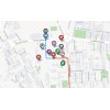
 Huércal-Overa and Mar Menor at Google Maps
Videos La Vuelta
 Instagram @lavuelta
 Vuelta a España Tweets


In which hotel is the sky team tonight?
Hi Peter
In the slideshow below the text you can find the teams hotels.
how can i find the road numbers for the route for stage 6
thanks for the info
Hi Brian
You can zoom in on the maps.
Then you’ll see details.
Hendrik
Hi. What time is the first rider expected at the finish?
Hi Richard,
we don’t have the exact times yet, but this is probably around 17:45.
Hendrik
Can you tell me yet where the finish actually is on stage 6 in San Javier, Murcia Spain please
Hi
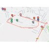
the finish is in San Javier, at the Av. Aviación Española.
Thank you so much Hendrik