Giro 2023 Route stage 15: Seregno - Bergamo
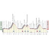
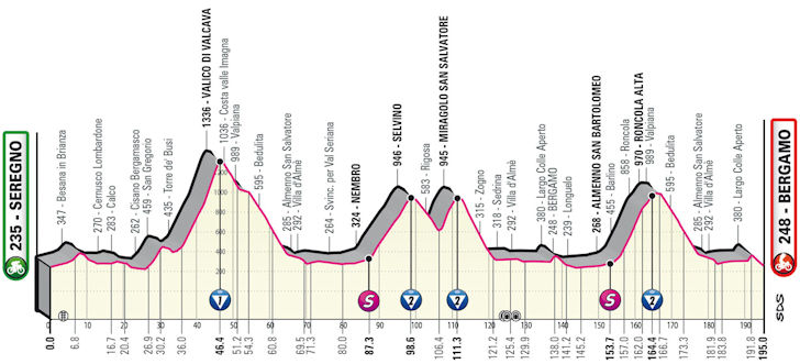
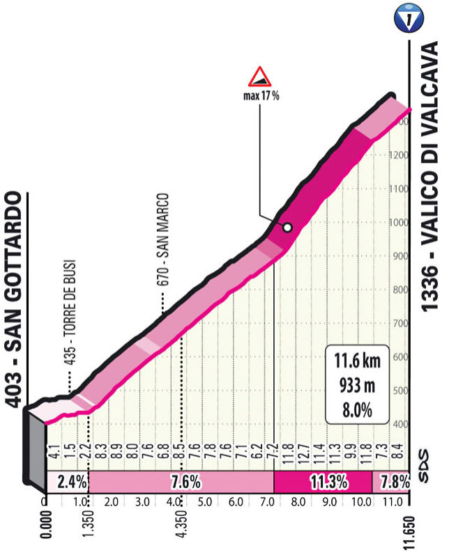
The race opens on slightly undulating terrain before the Valico di Valcava appears after 35 kilometres. The 11.6 kilometres climb rises to the highest point of the route at 1,336 metres. The average gradient sits at 8%, while the steepest sector at 17% comes 7.5 kilometres into the ascent, after which the slope does not drop below 10% for 3 kilometres straight.
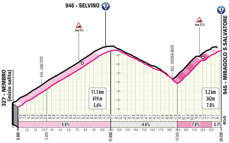
A long descent and 20 kilometres on the flat precede the climb to Selvino, a village northeast of Bergamo. The ascent is 11.1 kilometres long and averaging 5.6%. Right after the downhill the Miragolo San Salvatore throws in another 5.2 kilometres at 7%.
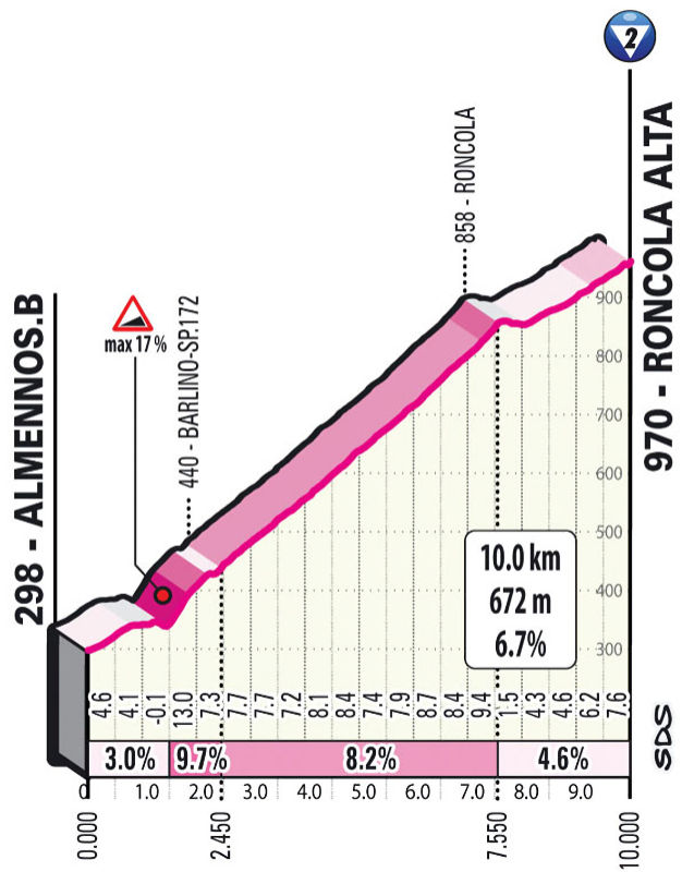
The riders move through Bergamo for the first time with almost 60 kilometres to go, only to race back towards the Valico di Valcava. They don't go all the way to the top this time though. Just before reaching an altitude of 1,000 metres they reach Roncola Alta after 10 kilometres of climbing at 6.7%.
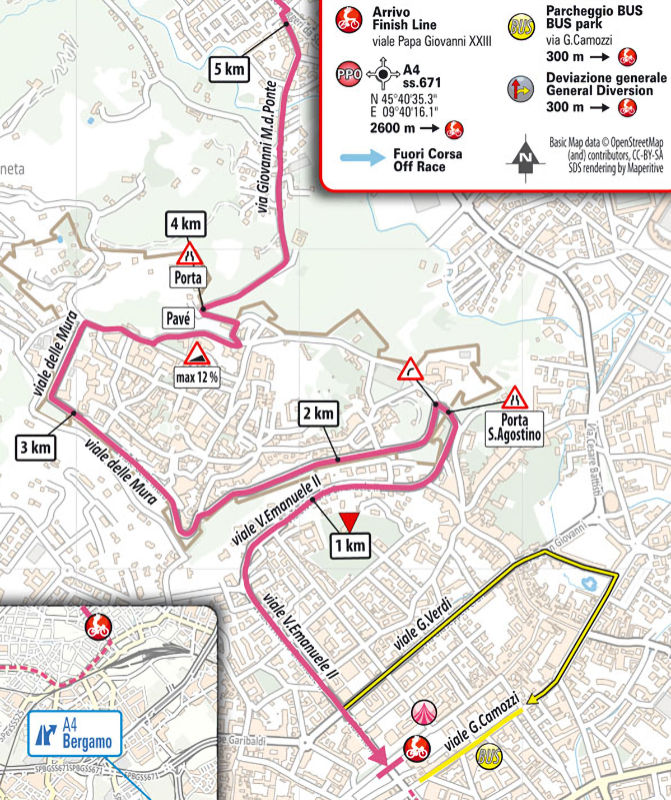
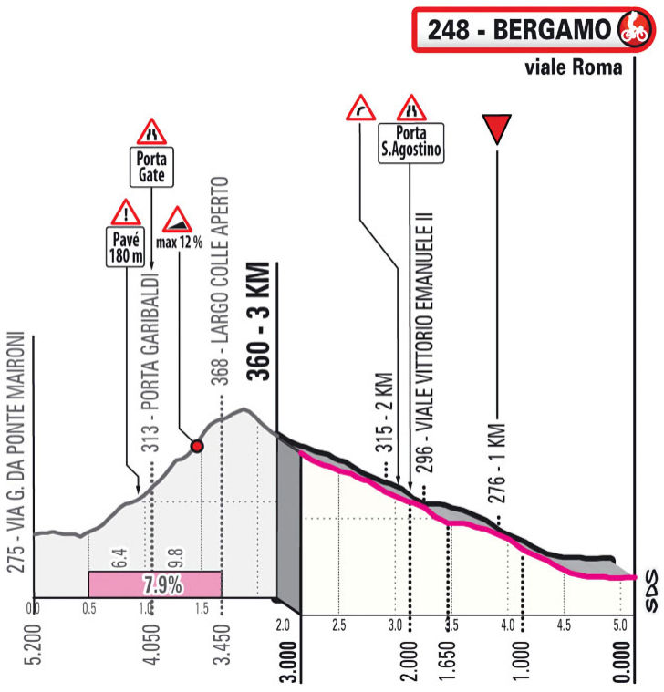
From Roncola Alta the riders enter a downhill back to the Brembo River. The route then continues on the flat to the outskirts of Bergamo. It would be easy to continue straight towards the finish line, but no, a punchy climb up to Città Alta - or, Upper Town - is introduced to add an extra element of excitement to the race.
The riders tackle the Colle Aperto, a ramp of 1.6 kilometres at 7.9% with the last part on pebble paving, before flying down into the Città Bassa - or, Lower City.
The second intermediate sprint comes with time bonuses of 3, 2 and 1 seconds, while 10, 6 and 4 seconds are awarded to the first three riders on the line.
Ride the route yourself? Download GPX stage 15 2023 Giro d'Italia.
Another interesting read: results 15th stage 2023 Giro.
Giro d'Italia 2023 stage 15: route, profile, more
Click the images to enlarge