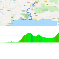
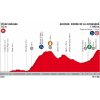
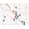
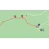
In the 4th stage the riders travel from the province of Málaga to the neighbouring province of Granada. Following the start in Vélez-Málaga the route moves along the Costa del Sol to turn inland in Almuñécar. La Vuelta follows the A-4050 to Jete and Otívar. This the Carretera de la Cabra – road of the goats -, an 18.2 kilometres climb with an average gradient of 5.2%. Following a short descent the route continues to climb for 5.8 kilometres at 4% before the riders fly down to the Embalse de los Bermejales.
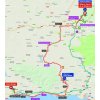
Starting at the reservoir the route climbs to the plateau on which Granada sits. A prolonged downhill false flat runs to the old town in the foothills of the Sierra Nevada. The race moves through Granada and shortly hits the final climb in the Sierra de la Alfaguara – 12.4 kilometres at 5.4% with its steepest ramps halfway up.
The first three riders on the line take time bonuses of 10, 6 and 4 seconds, while the intermediate sprint (at kilometre 143.5) comes with 3, 2 and 1 seconds.
Read also: results/race report 4th stage 2018 Vuelta a España.
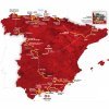
Vuelta a España 2018 stage 4: Route maps, height profiles, and more
Click on the images to zoom
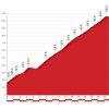 Details Alto de la Cabra Montés
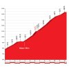 Details Puerto de Alfacar
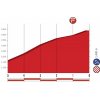 Profile final kilometres
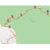 Route final kilometres
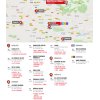 Teams hotels
 Scheduled times 4th stage
 Vélez-Málaga and La Alfaguara at Google Maps
Videos La Vuelta
