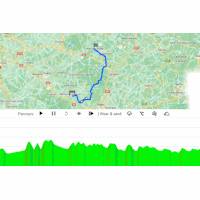
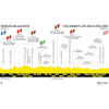
Tour de France 2024 Route stage 8: Semur-en-Auxois - Colombey-les-Deux-Églises
It's a first for Colombey-les-Deux-Églises, while starting venue Semur-en-Auxois featured once before on Le Tour. The 6th stage of the 2007 edition sets off from the ancient town on the Armancon River to finish in Bourg-en-Bresse, where Tom Boonen outsprinted Óscar Freire.
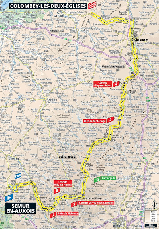
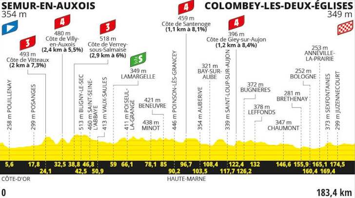
The 8th stage traverses the hilly terrain of the Côte-d’Or, a département in Burgundy. The riders tackle the Côte de Vitteaux (3.2 kilometres at 5.8%), Côte de Villy-en-Auxois (2.7 kilometres 5.4%), Côte de Verrey-sous-Salmaise (3.6 kilometres at 5.2%) in the first 50 kilometres. The subsequent section of 50 kilometres is played out on rolling terrain before the Côte de Sainenoge adds 1.5 kilometres at 7.1% to the mix.
Following the Côte de Bay-sur-Aube (2.7 kilometres at 4.7%) and Côte de Giey-sur-Aujon (1.4 kilometres at 7.2%) there are 44 kilometres remaining. The race then continues on flat to rolling roads towards the Côte de Eufigneix. This 2.2 kilometres climb at 4.5% is crested 15 kilometres before the finish line in Colombey-les-Deux-Églises.
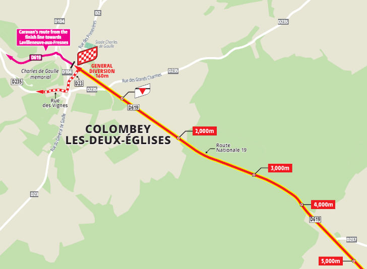
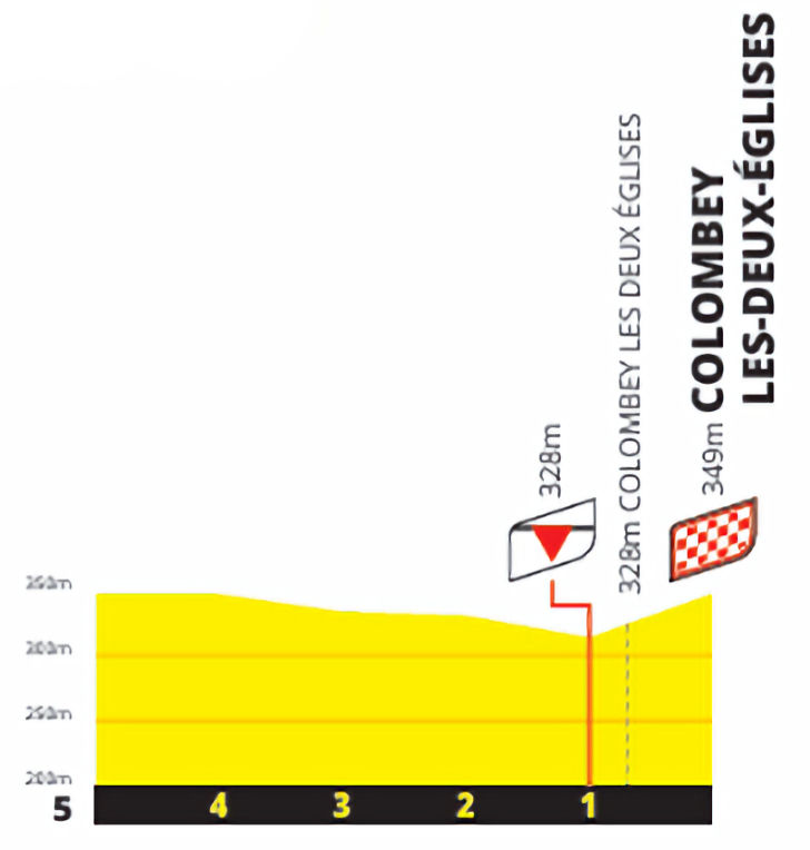
The final kilometre goes up at 3%.
The first three riders across the line gain time bonuses of 10, 6, and 4 seconds.
Ride the route yourself? Download GPX 8th stage 2024 Tour de France.
Another interesting read: results 8th stage 2024 Tour de France.
Tour de France 2024 stage 8: routes, profiles, videos
Click the images to enlarge