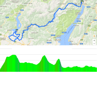
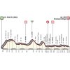
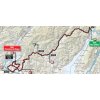
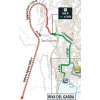
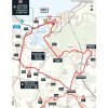
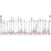
Unsurprisingly, Riva del Garda lies at Lake Garda, south of the Alps. The route of stage 17 avoids the high mountains and heads the other way. Shortly, the riders tackle the first uphill section, which climbs in 10 kilometres (mostly through a tunnel) to Molina di Ledro. The average gradient is a little over 5%.
The route continues along Lago Ledro, still slightly climbing all the way to Lago di Ampola. At kilometre 24 a drop leads to a flat section that runs to the KOM climb to Lodrino – 10 kilometres at 4%. Located at 736 metres, the old village – which was first mentioned as far back as 857 AD – is the highest point in today’s route.
Following a long and gradual drop the route climbs one more time. Again, not the hardest climb of the world, averaging at almost 5% for 6 kilometres. At the summit the race is 94 kilometres underway.
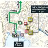
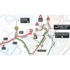
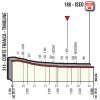
The last third of the route is played out on the flat. The riders move through arrival place Iseo with almost 30 kilometres remaining. In the last 5 kilometres they hit the roads that they raced before, so the finale is familiar. The route takes in a number of roundabouts, including the last (wide) one with some 500 metres to go.
The first three riders on the line win time bonuses of 10, 6 and 4 seconds, while the last of two intermediate sprints (at kilometre 56.4 and at kilometre 119.4) comes with 3, 2 and 1 seconds.
Read also: results/race report 17th stage 2018 Giro d’Italia.
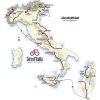
Giro d’Italia 2018 stage 17: Route maps, height profiles, and more
Click on the images to zoom
