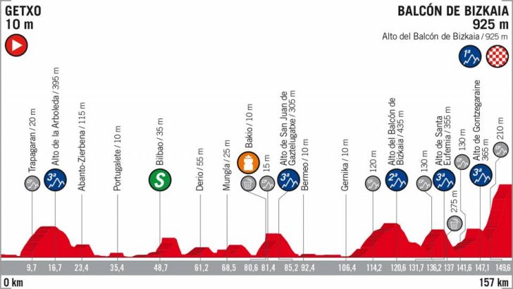
Vuelta 2018 Route stage 17: Getxo - Balcón de Bizkaia
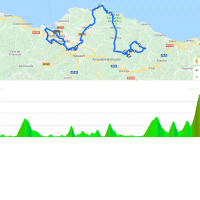
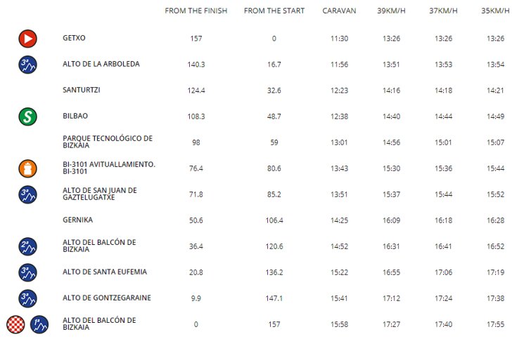
Jonathan Castroviejo, the former European Champion time trialing who rides for Team Sky, lives in Getxo. Following the neutralized start the route continues to the proper start in Bilbao, near the Athletic Bilbao football stadium San Mamés. The riders head for the Alto de la Arboleda, a 6.9 kilometres climb at 5.2% with its peak at kilometre 16.7.
Following the descent the route is Spanish flat - which means the route is far from flat, yet there are no KOM points to be gained. For instance, the riders once again move through Bilbao (at kilometre 48) before they hit a 3 kilometres climb at 6.4%. Those eyeing up the polka dot jersey have to wait for the Alto de San Juan de Gaztelugatxe, a 4.2 kilometres climb at 6.3% that leads to a gorgeous sea view at the top. The San Juan de Gaztelugatxe is crested at kilometre 85.
The riders drop down to a section of some 20 kilometres on the flat. Still almost 50 kilometres out and five climbs to go. First the Balcón de Bizkaia, a 10.2 kilometres slope at 3.7%. A right-hand turn while going downhill would lead to the finish, but no, that would be too easy. A loop northeast of the arrival takes in the Alto de Santo Eufemia, a 3.8 kilometres climb at 6.1% with some double digits ramps early on, before continuing onto the foot of the Gontzegaraine, which slopes at 4% for 5.3 kilometres.
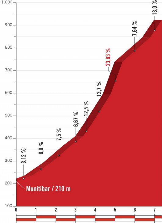
Where the descent meets the old route - in Munitibar - the riders turn left to climb back up to the Balcón de Bizkaia. The first 3.2 kilometres climb at 6 to 7% and when the route turns left, the ascent gets steeper. Actually, this is the road to the summit of Monte Oiz, but the route doesn't go all the way to the top. The Oiz peaks at 1,026 metres while the finish lies at an elevation of 925 metres.
Getting closer to the line, the road conditions worsen. It's merely a narrow corrugated concrete track with impossibly steep ramps up to almost 24%. The last 3.9 kilometres to the finish ride at 11%, while the final climb from Munitibar is a 7.1 kilometres toil with an average gradient of 9.1%.
The first three riders on the line take time bonuses of 10, 6 and 4 seconds, while the intermediate sprint (at kilometre 48.7) comes with 3, 2 and 1 seconds.
Read also: results/race report 17th stage 2018 Vuelta a España.
Vuelta a España 2018 stage 17: Route map, height profile, and more
Click the images to enlarge

 Details Alto del Balcón de Bizkaia (2nd time)
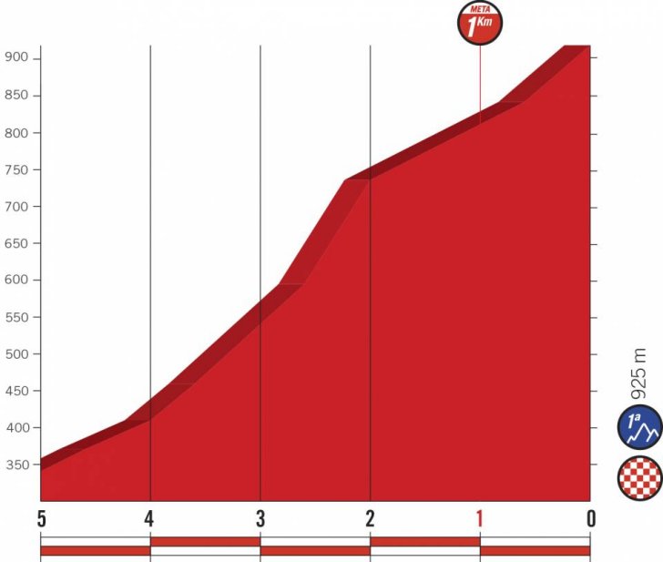 Profile final kilometres
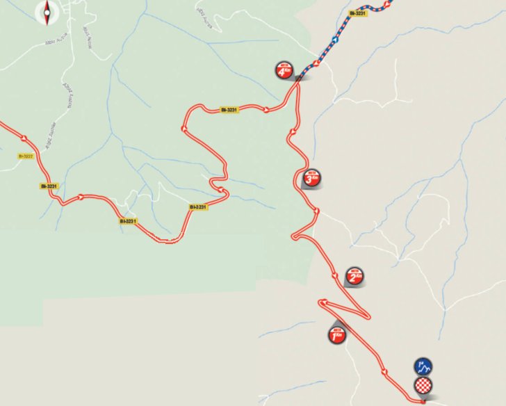 Route final kilometres
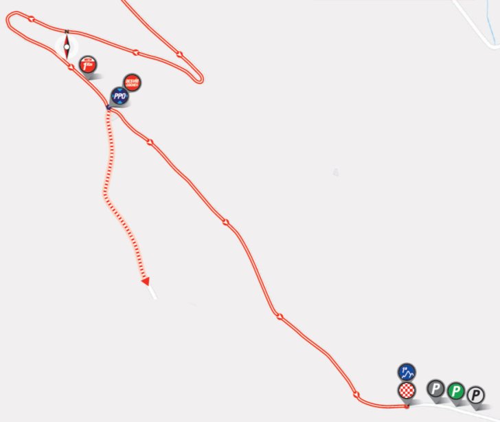 Details finish