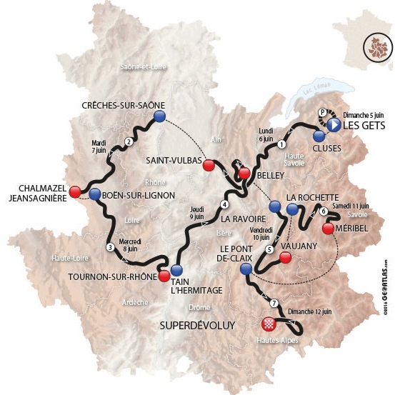
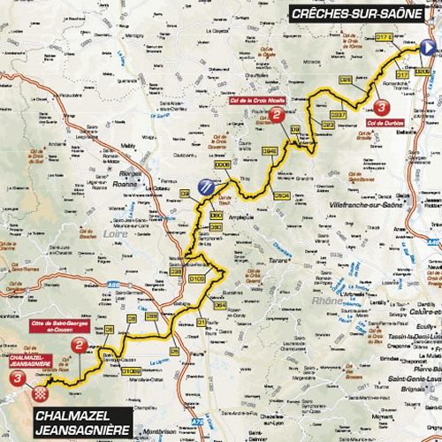
Critérium du Dauphiné 2016 Route stage 2: Crêches-sur-Saône - Chalmazel/Jeansagnière

In 2014, stage 5 in Paris-Nice left from Crêches-sur-Saône. The race finished in Rive de Gier and was won by Carlos Betancur, who went on to take the overall victory.
In stage 2 of this year's Dauphiné the arrival town is located more to the west of France. Chalmazel and Jeansagnière are one commune as of January 1, 2016. The arrival place lies amidst the Parc Naturel Régional Livradois-Forez, which is in the Massif Central, an elevated region with mountains and plateaus in the middle of the south of France.
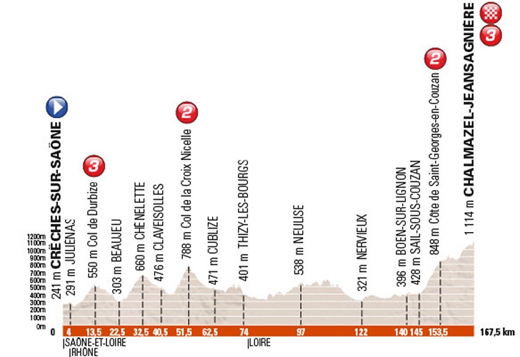
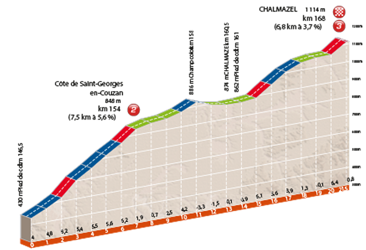
After leaving Crêches-sur-Saône the riders race over rolling roads. The closing climb comes in two stages and totals 21.5 kilometres. First the riders climb up Côte de Saint-Georges-en-Couzan - 7,5 kilometers at 5.6% -, and at the top the road rolls on for something like 5 kilometres before the irregular closing climb to the ski resort of Chalmazel kicks in. This climb comes with a 3.6% grade in 6.8 kilometres. The steepest sections (at around 6%) are at the bottom and nearthe top, while the last 500 metres are a false flat
At the finish line, time bonuses at 10, 6 and 4 seconds lay waiting first the first three riders.
Race results/race report stage 2, 2016 Critérium du Dauphiné.
Critérium du Dauphiné 2016 stage 2: route maps, height profiles, etc.
Click the images to enlarge