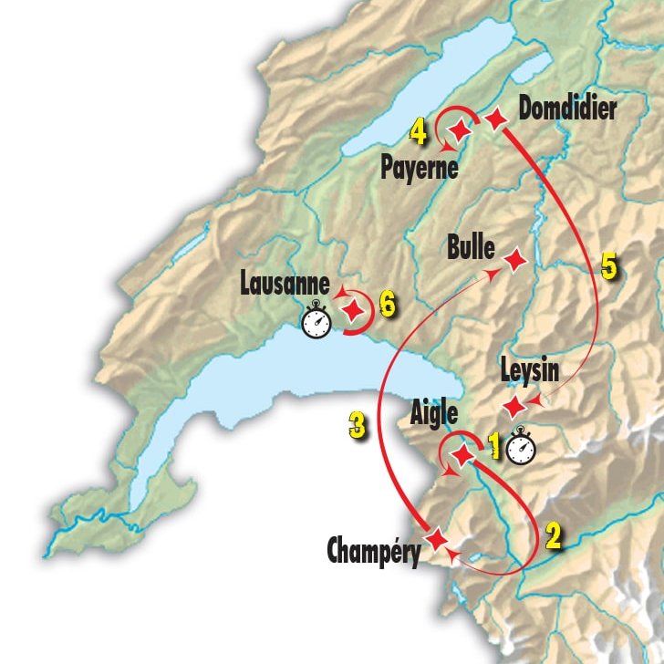
Tour de Romandie 2017 Route stage 3: Criterium in Payerne
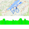
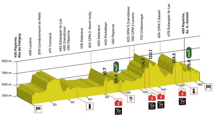
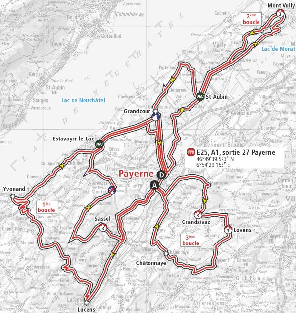
After the start the riders set out for the first loop, which runs in south-westerly direction. At an elevation of 679 metres, they reach the highest point of the day, yet there are no KOM-points in the first loop.
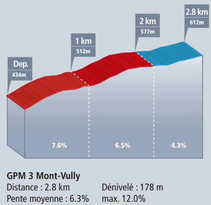
The second loop runs to the north-east. Mount Vully is halfway, crested at kilometre 81.7 after a 2.8 kilometres climbing at 6.3% with steepest sectors of 12%.
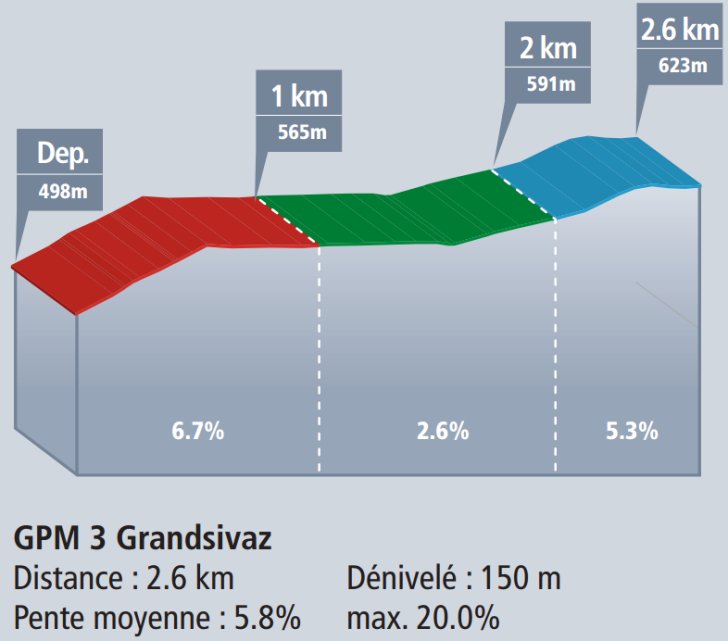
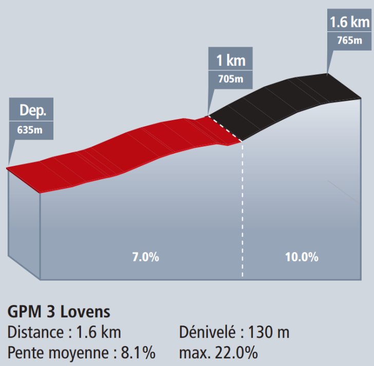
Back in Payerne it's time for the first passage on the finish line. At 35.5 kilometres, the next loop is the shortest, yet it features most KOM-climbs - namely two. The first one is 2.6 kilometres at 5.8% with ramps up to 20%, while the second climb is 1.6 kilometre at 8.1% with ramps of up to 22%. So that's punchy stuff.
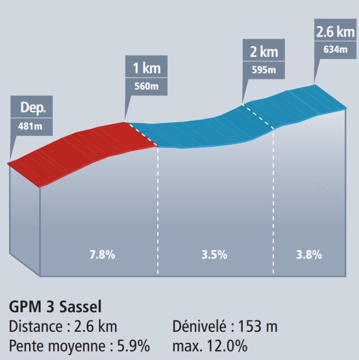
The last loop takes in 41.5 kilometres and one climb - 2.6 kilometres at 5.9%. On the top there are almost 30 kilometres left to race. Mostly on rolling roads but the last 5 kilometres are pan-flat.
The intermediate sprints give no bonus seconds, but the first three riders on the line take a bonus of 10, 6 and 4 seconds.
Results/race report 3rd stage of the 2017 Tour de Romandie.
Tour de Romandie 2017 stage 3: Route maps, height profiles, and more
Click the images to enlarge