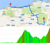
Giro 2017 Route stage 4: Cefalù - Mount Etna
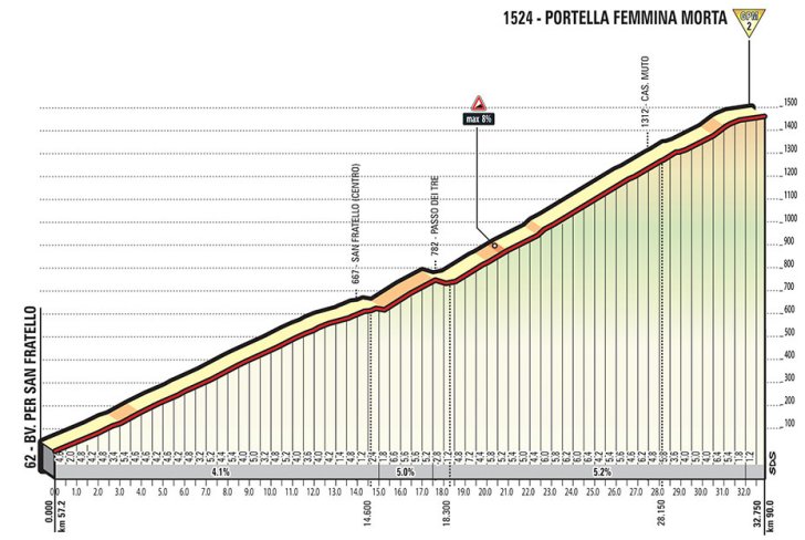
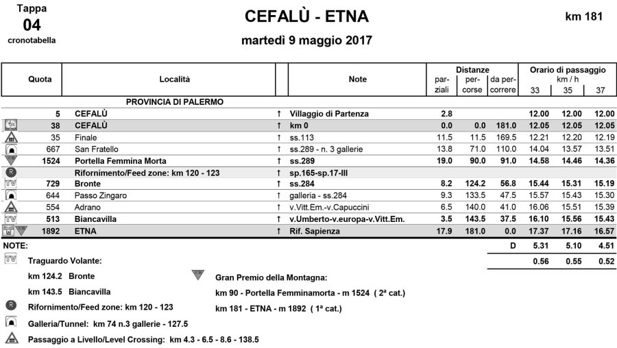
The pack leaves from coastal town Cefalù to set sail for Santoe Stefano di Camastra and further east. With 57 kilometres done, the riders hit the lower slopes of Portella Fermina Morta. The climb starts in Acquedolci at sea level to keep climbing to an elevation of 1,435 metres. With its length at 32,75 kilometres this definitely is a warm welcome on Nibali’s native ground, although the average gradient is modest: 4.5%.
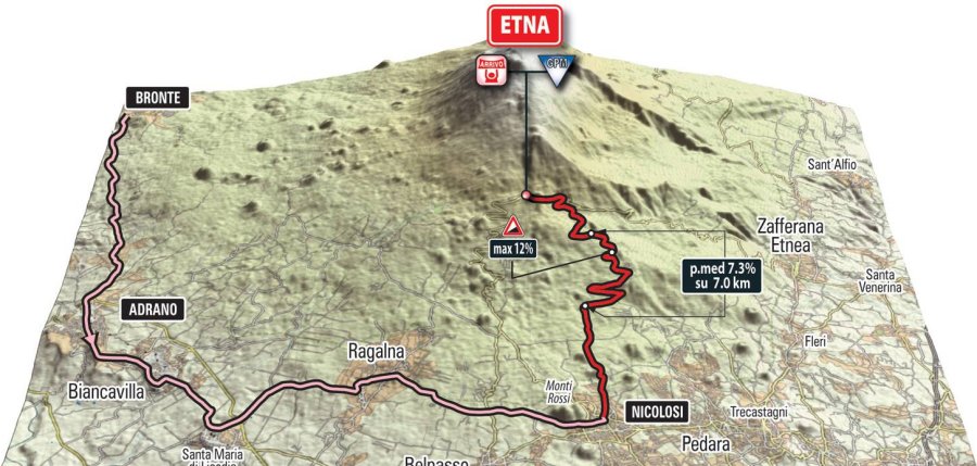
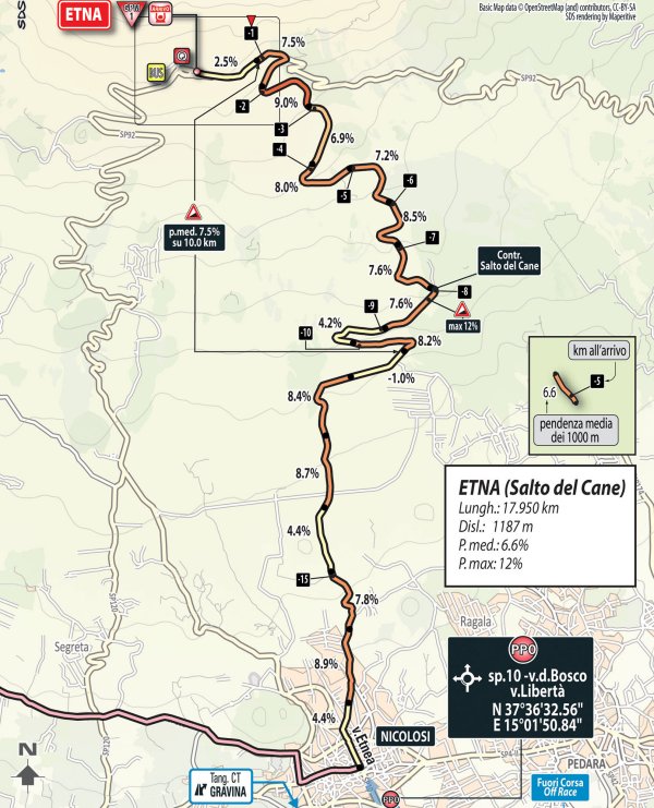
Following a 30 kilometres drop an undulating section takes the riders to Nicolosi, located on the south side of Mount Etna. With 162 kilometres done this is the moment to be alert as it’s here the closing climb to Rifugio Sapienza begins. In 17.95 kilometres the route takes in 1,187 vertical metres, therefore the average gradient is 6.6%.
Mount Etna featured in the 2011 Giro d’Italia with a double ascent in stage 9, which was won by Alberto Contador. Two weeks later the Spaniard pocketed the overall, yet both these victories were taken from him in 2012 after clenbuterol charges dating back to the 2010 Tour de France. The 2011 Giro title went to runner-up Michele Scarponi, while José Rujano retroactively became the winner on Mount Etna.
The first three riders on the line take time bonuses of 10, 6 and 4 seconds, while the final intermediate sprint (at kilometre 143.5) comes with 3, 2 and 1 seconds.
Results/race report 4th stage 2017 Giro d'Italia
Giro 2017 stage 4: Route maps, height profiles, and more
Click the images to enlarge